OMAHA, Neb. (AP) — A significant storm system is currently impacting millions across the central United States, creating blizzard conditions in parts of the Midwest and Great Plains, while neighboring states face threats from high winds and wildfires. On Wednesday, approximately 72 million individuals were placed under wind advisories or warnings, with gusts exceeding 45 mph (72 kph), according to Bryan Jackson, a meteorologist from the National Weather Service's Weather Prediction Center.
This time of year sees a clash between cold air lingering in the north and warm air from the south, resulting in the formation of strong, low-pressure systems. Jackson noted that Wednesday's weather represents the third rapid storm system to develop in recent weeks, indicating a "very active pattern" since February. The previous weekend witnessed at least 42 fatalities due to dynamic storms that produced tornadoes, blinding dust, and wildfires, destroying trees and damaging homes and businesses across eight states in the Southern and Midwestern regions.
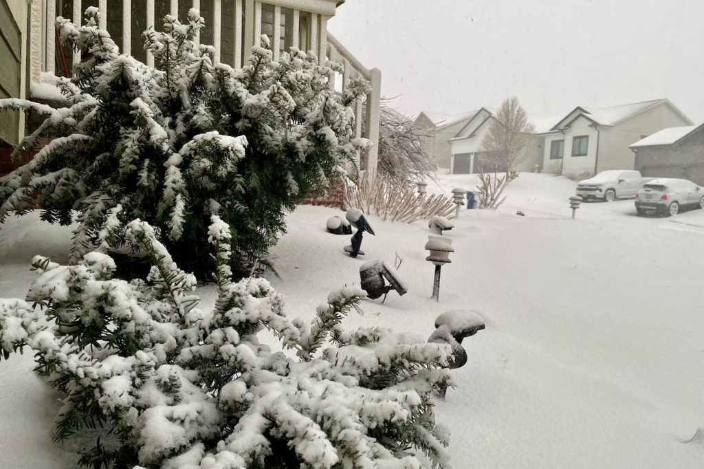
Some areas from southwestern Kansas to central Wisconsin could experience snowfall ranging from 2 inches (5 centimeters) to up to 1 foot (30 cm). This, combined with high winds, prompted forecasters to issue warnings about potential whiteout conditions. In response to the inclement weather, the Kansas Department of Transportation closed over 250 miles (402 kilometers) of Interstate 70, stretching from the Colorado border to Salina, Kansas. The initial closure impacted a 39-mile (62 km) stretch between Goodland and Colby, where eight fatalities occurred following a dust storm that led to a major pileup involving 71 vehicles.
Blizzard conditions early Wednesday created near-zero visibility in south-central Nebraska, with the state patrol advising residents to avoid travel. More than 160 miles (257 km) of Interstate 80 were closed due to the harsh weather, with blockages caused by a jackknifed semi-trailer further complicating traffic. Power outages affected around 42,000 households and businesses throughout eastern Nebraska, as falling tree branches due to heavy snow and strong winds led to school closures. Additionally, crashes contributed to road closures in northwestern Iowa amidst the ongoing storm.
The sudden arrival of the storm created drastic weather changes for residents, especially for those who experienced spring-like temperatures exceeding 70 degrees Fahrenheit (21 degrees Celsius) just a day prior. In areas where snowfall is absent, strong winds persist, exacerbated by dry conditions spanning from Texas and Oklahoma through Arkansas and Missouri, elevating the risk for wildfires.
Jackson highlighted that before plants begin to grow, there remains ample dry fuel available. Consequently, wildfire threats intensified on Tuesday and continued into Wednesday, particularly in parts of Oklahoma that are still recovering from a previous outbreak of wildfires that began on Friday. Reports indicate that more than 400 homes were either severely damaged or destroyed, with at least four fatalities linked to the fires and high winds, including one death resulting from a vehicle accident attributed to poor visibility caused by dust or smoke.
Furthermore, the potential for severe thunderstorms threatened central Illinois on Wednesday afternoon, bringing risks of hail, strong winds, and tornadoes. A slight risk of severe weather was forecasted for much of Illinois and Indiana, with reduced risk extending further south into the Tennessee Valley. Jackson commented that the storm affecting the central U.S. on Wednesday is expected to push a cold front across the eastern seaboard by late Thursday. This shift may bring a renewed low-pressure system capable of producing heavier snowfall in higher elevation areas of New England.
___
Hannah Fingerhut and Margery A. Beck reported from Des Moines, Iowa, and Topeka, Kansas, respectively.